“NISAR Satellite Captures Stunning Earth Images: Monitoring Earth Every 12 Days in NASA-India Mission”
In July, a pioneering mission was launched with the promise of revolutionizing Earth observation. Shortly after reaching orbit, the mission has already transmitted its initial radar images, offering a glimpse of how this “global sentinel” will transform the field.
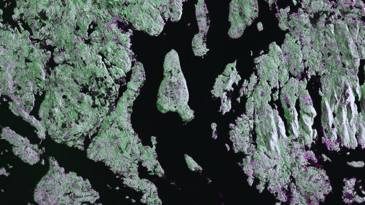
### First Images: From North Dakota to Maine

On August 21st, an image of Mount Desert Island, Maine was captured showing green vegetation and magenta ground or buildings. Two days later, another image from North Dakota depicted a region of farmland surrounded by dense vegetation.
### How the “Weather-Proof Radar” Works

Unlike other satellites that rely on favorable weather conditions, NISAR utilizes a synthetic aperture radar in two frequencies (L-band and S-band). This enables it to penetrate clouds, map vegetated surfaces, and detect subtle movements in the Earth’s crust.
### A Sentinel Against Disasters and Global Changes

Beyond its impressive images, NISAR serves a practical purpose in monitoring natural and environmental risks. Its continuous scanning will aid in detecting tectonic movements that could predict earthquakes, measuring glacier melting, analyzing ecosystem alterations, and monitoring crop growth.
Priced at over $1.5 billion, NISAR is recognized as the most costly Earth observation satellite in history. Currently positioned in a heliosynchronous orbit at an altitude of 747 kilometers, it will commence its scientific phase in November following initial assessments.