
Be careful: The massive storm shaking things up and creating chaos
During hurricane season, a massive atmospheric phenomenon has captured global attention. This hurricane has rapidly grown to an extraordinary size, becoming one of the largest ever observed. Although its eye remains offshore, its violent presence is already impacting the shores of several countries, highlighting the real threat posed by its effects.
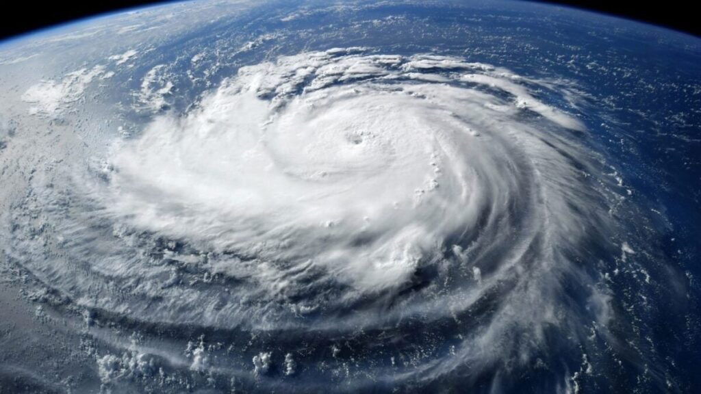
### A Titan that Defied Statistics
Typically, cyclones measure between 500 and 800 kilometers in diameter, with rare cases reaching up to 1,000 km. However, this hurricane has broken all records: NASA satellite images revealed an extension of 1,300 km, with cloud bands stretching up to 1,400 km.
Erin underwent rapid intensification, escalating from a Category 1 to a Category 5 hurricane in just 24 hours. NASA’s GPM Core Observatory captured footage of Hurricane Erin intensifying at 6:23 a.m. EDT on August 16th.
Its intensification was remarkable, reaching Category 5 status within a day, showcasing storm columns in 3D towering over 15 km in height.
### The East Coast of the United States on High Alert
Although a direct impact is not anticipated, the consequences are already being felt along the coast. North Carolina declared a state of emergency with mandatory evacuations in high-risk areas, particularly on the Outer Banks islands.
Coastal homes have been destroyed by waves measuring between 3 and 6 meters, while the National Hurricane Center issued warnings about coastal flooding. Concerns about rip currents, which can drag swimmers out to sea, have been raised along the Atlantic coast from Virginia to New Jersey.
While not as devastating as last year’s Hurricane Milton, the secondary effects of this cyclone demonstrate that even without making landfall, a hurricane of this magnitude can disrupt coastal life and result in significant losses.
### An Origin Marked by Tragedy
This hurricane’s impact has been felt since its formation, with intense rains causing havoc in the Cape Verde archipelago when it was still a tropical wave in the eastern Atlantic. Flash floods on São Vicente claimed the lives of nine people, serving as an early warning of the destructive force associated with this weather system.
Since then, its evolution has been closely monitored internationally, with evacuations, beach closures, loss of life, and anticipated complications extending all the way to Northern Europe, where the hurricane is expected to arrive weakened but still potent.