The ESA unveils 3D images exposing ancient water channels on Mars: unveiling the origins of the red planet’s terrain
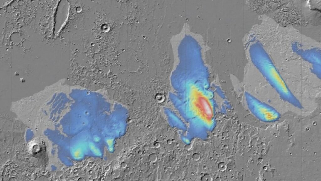
For years, scientists have suspected that Mars was a world of water. Now, an animation released by the European Space Agency (ESA) offers the most visually stunning evidence to date: a 3D flyover that travels through channels, islands, and craters sculpted by ancient Martian rivers. The images, obtained by the Mars Express probe, show how the red planet may have once been blue.
A digital journey through Mars’s watery past
The video released by the ESA allows you to “navigate” over a region called Xanthe Terra, at the Martian equator, where countless valleys and channels formed by liquid water intersect. The journey follows the course of Shalbatana Vallis, a 1,300-kilometer-long river system that descends from the Southern Highlands to the northern plains, where it would have spread out.
How the 3D animation was created
The video is not just a visual reconstruction: it is a technical feat. To achieve the immersive effect, engineers rendered 50 frames per second, simulating the movement of a virtual camera along the Martian terrain. Each scene was based on a digital model of the relief, with a triple vertical exaggeration to highlight terrain details. Atmospheric effects—mist, shadows, and diffuse clouds—were added to smooth transitions and recreate a real flight sensation over the planet. The result is an experience that brings viewers closer to what Mars might have looked like when rivers flowed across its surface. According to the ESA, “the flight travels through curved channels carved by water, erosion-resistant islands, and a maze of mountainous terrains that bear witness to the force of ancient riverbeds.”